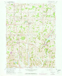
1960 Map of Homeworth
USGS Topo · Published 1973About this map
Fairmount Childrens Home stands as a prominent institution in the northwest corner of this landscape, situated near the Fairmount Mem Park (Cem) and Fairmount Ch. The terrain transitions from the relatively level agricultural fields of Washington and Knox townships into the more dissected drainage basins of Sandy Cr and Middle Branch to the south. This 1960s-era topography reveals a rural economy still tied to the Penn Central rail line, which connects the small village centers of Homeworth, Moultrie, and Bayard.
Find a feature on this map
43 named features on this map. Tap any name to fly to it.
Don’t see what you’re looking for? This feature index may not catch every label — zoom into the map to look around manually.
Map Details
Editions of this 1960 Homeworth Map
4 editions found
Other maps of this area

1905 · Salineville
USGS Topo · 1:62,500

1909 · Alliance
USGS Topo · 1:62,500

1909 · Lisbon
USGS Topo · 1:62,500

1910 · Carrollton
USGS Topo · 1:62,500

1912 · Carrollton
USGS Topo · 1:62,500

1951 · Canton
USGS Topo · 1:250,000

1952 · Alliance
USGS Topo · 1:24,000

1952 · Damascus
USGS Topo · 1:24,000

1953 · Canton
USGS Topo · 1:250,000

1957 · Canton
USGS Topo · 1:250,000