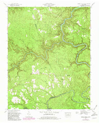
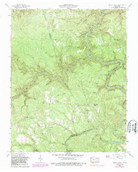
1952 Map of Honey Creek
USGS Topo · Published 1980About this map
Scott State Forest blankets the dissected plateau of the northern Cumberland Plateau in this mid-century topographic record. The landscape is defined by the winding course of the South Fork Cumberland River and the Clear Fork, which carve deep gorges into the terrain. Human activity is concentrated along the ridges and small clearings, evidenced by the scattered community infrastructure of the Honey Creek School and Honey Creek Church.
Find a feature on this map
44 named features on this map. Tap any name to fly to it.
Don’t see what you’re looking for? This feature index may not catch every label — zoom into the map to look around manually.
Map Details
Editions of this 1952 Honey Creek Map
6 editions found
Other maps of this area

1895 · Wartburg
USGS Topo · 1:125,000

1896 · Wartburg
USGS Topo · 1:125,000

1934 · Barthell
USGS Topo · 1:62,500

1934 · Pall Mall
USGS Topo · 1:62,500

1952 · Helenwood
USGS Topo · 1:24,000

1952 · Honey Creek
USGS Topo · 1:24,000

1952 · Rugby
USGS Topo · 1:24,000
1952 · Robbins
USGS Topo · 1:24,000

1954 · Stockton
USGS Topo · 1:24,000

1954 · Burrville
USGS Topo · 1:24,000