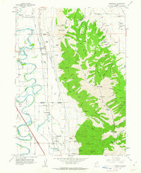
1961 Map of Honeyville
USGS Topo · Published 1963About this map
The Bear River meanders sharply through the valley floor, defining the western agricultural landscape near the settlements of Elwood and Madsen. This early 1960s survey captures the vital water infrastructure of the region, including the Hammond Canal and the Deweyville Canal, which skirt the base of the towering Wellsville Mountains. The eastern half of the map is dominated by the steep slopes of the Cache National Forest, carved by numerous drainages such as Big Canyon and Cottonwood Canyon.
Find a feature on this map
87 named features on this map. Tap any name to fly to it.
Don’t see what you’re looking for? This feature index may not catch every label — zoom into the map to look around manually.
Map Details
Editions of this 1961 Honeyville Map
2 editions found

Other maps of this area

1914 · Logan
USGS Topo · 1:125,000

1916 · Logan
USGS Topo · 1:125,000

1954 · Ogden
USGS Topo · 1:250,000

1954 · Brigham City
USGS Topo · 1:250,000

1955 · Bear River City
USGS Topo · 1:24,000

1955 · Mount Pisgah
USGS Topo · 1:24,000

1955 · Brigham City
USGS Topo · 1:24,000

1958 · Ogden
USGS Topo · 1:250,000

1958 · Brigham City
USGS Topo · 1:250,000

1960 · Ogden
USGS Topo · 1:250,000