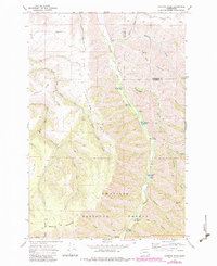
1967 Map of Hopkins Ridge
USGS Topo · Published 1983About this map
The Tucannon River carves a deep path through this section of the Umatilla National Forest, creating a landscape defined by sharp elevation shifts between Hopkins Ridge and Maloney Mountain. The river corridor serves as a hub for both resource management and recreation, evidenced by the Tucannon Guard Sta and a Fish Hatchery near Blue Lake. A string of small alpine waters, including Rainbow Lake, Deer Lake, and Watson Lake, follow the river’s course southward.
Find a feature on this map
33 named features on this map. Tap any name to fly to it.
Don’t see what you’re looking for? This feature index may not catch every label — zoom into the map to look around manually.
Map Details
Editions of this 1967 Hopkins Ridge Map
4 editions found
Other maps of this area

1937 · Pomeroy
USGS Topo · 1:96,000

1942 · Pomeroy
USGS Topo · 1:125,000

1955 · Pullman
USGS Topo · 1:250,000

1958 · Pullman
USGS Topo · 1:250,000

1967 · Rose Springs
USGS Topo · 1:24,000

1967 · Hopkins Ridge
USGS Topo · 1:24,000

1967 · Cahill Mtn
USGS Topo · 1:24,000
1967 · Pomeroy
USGS Topo · 1:24,000

1967 · Stentz Spring
USGS Topo · 1:24,000

1967 · Turner
USGS Topo · 1:24,000