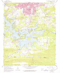
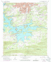
1966 Map of Hot Springs South
USGS Topo · Published 1977About this map
Oaklawn Racetrack and the Hot Springs Memorial Field anchor the southern periphery of Hot Springs during this mid-century period. The map highlights a city transitioning from its historical resort roots toward modern suburban expansion, with numerous cemeteries like Greenwood Cemetery and Jewish Rest Cem reflecting the community's long-established history. South of the city, the landscape is dominated by the reservoir system, including the irregular shoreline of Lake Hamilton and the western edge of Lake Catherine, separated by the Carpenter Dam.
Find a feature on this map
82 named features on this map. Tap any name to fly to it.
Don’t see what you’re looking for? This feature index may not catch every label — zoom into the map to look around manually.
Map Details
Editions of this 1966 Hot Springs South Map
5 editions found
Other maps of this area

1890 · Benton
USGS Topo · 1:125,000

1890 · Hot Springs
USGS Topo · 1:125,000

1894 · Hot Springs
USGS Topo · 1:125,000

1894 · Benton
USGS Topo · 1:125,000

1948 · Malvern
USGS Topo · 1:62,500

1949 · Malvern
USGS Topo · 1:62,500

1955 · Little Rock
USGS Topo · 1:250,000

1956 · Little Rock
USGS Topo · 1:250,000

1960 · Little Rock
USGS Topo · 1:250,000

1964 · Little Rock
USGS Topo · 1:250,000