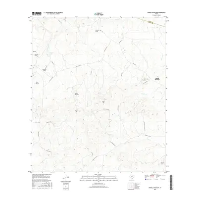
2016 Map of Howell Mountain
USGS Topo · Published 2016About this map
Howell Mountain and Rattlesnake Mtn anchor the high ground of the Texas Hill Country along the border of Llano and Blanco counties. This landscape is defined by the hydrologic boundary of The Great Divide, where drainages split toward Cypress Cr and Hickory Cr. The settlement of Round Mountain sits in the eastern reaches, surrounded by a network of ranching properties and private airfields including the Moursund Ranch Airport and West Ranch Airport. Numerous gaps and hollows, such as Porter Gap and Anderson Hollow, reveal the deeply eroded character of this limestone terrain. Rural transit is facilitated by routes like Farm Rd 962 and Round Mt - Sandy Rd, which connect the scattered homesteads and ranch lands that dominate the region's modern land use.
Find a feature on this map
41 named features on this map. Tap any name to fly to it.
Don’t see what you’re looking for? This feature index may not catch every label — zoom into the map to look around manually.
Map Details
Editions of this 2016 Howell Mountain Map
This is the sole edition of this map. No revisions or reprints were ever made.
Other maps of this area

1887 · Llano
USGS Topo · 1:125,000

1887 · Blanco
USGS Topo · 1:125,000

1887 · Burnet
USGS Topo · 1:125,000

1893 · Burnet
USGS Topo · 1:125,000

1894 · Fredericksburg
USGS Topo · 1:125,000

1894 · Blanco
USGS Topo · 1:125,000

1894 · Llano
USGS Topo · 1:125,000

1903 · Burnet
USGS Topo · 1:125,000

1904 · Llano
USGS Topo · 1:125,000

1909 · Llano
USGS Topo · 1:125,000