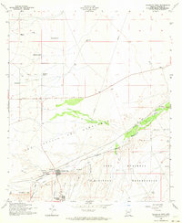
1958 Map of Huachuca Vista
USGS Topo · Published 1964About this map
The San Ignacio Del Babocomari land grant dominates the central portion of this 1958 survey, where the Babocomari River flows through a landscape defined by ranching and military presence. To the south, the Fort Huachuca Military Reservation boundary borders the small settlements of Huachuca Vista and Huachuca Village. These communities, along with the stop at Campstone, are tied to the corridor of the Southern Pacific railroad, which runs parallel to the river.
Find a feature on this map
24 named features on this map. Tap any name to fly to it.
Don’t see what you’re looking for? This feature index may not catch every label — zoom into the map to look around manually.
Map Details
Editions of this 1958 Huachuca Vista Map
4 editions found
Other maps of this area

1915 · Benson
USGS Topo · 1:125,000

1922 · St. David
USGS Topo · 1:62,500

1926 · Whetstone
USGS Topo · 1:62,500

1932 · Fairbank
USGS Topo · 1:62,500

1938 · Huachuca
USGS Topo · 1:62,500

1943 · Benson
USGS Topo · 1:125,000

1948 · Fort Huachuca NE
USGS Topo · 1:24,000
1948 · Mustang Mountains
USGS Topo · 1:24,000
1948 · Fort Huachuca SW
USGS Topo · 1:24,000
1948 · Fort Huachuca
USGS Topo · 1:24,000