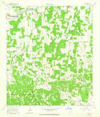
1961 Map of Hye
USGS Topo · Published 1964About this map
The LBJ Ranch and the small settlement of Hye anchor the northern reaches of this Hill Country landscape, where the Pedernales River winds through the valley. Local life in the early 1960s is evidenced by a network of family-named ranches and communal centers, including the Rocky Community and the village of Albert. Cultural landmarks like the Old Junction School (Historical) and Pleasant Hill Sch point to the area's educational history, while the Johnson Cem and American Ch mark the spiritual and ancestral hubs of the community. The terrain is defined by the headwaters and forks of Rocky Creek, Williams Creek, and the West Prong Big Creek, which carve through the limestone-rich hills of Gillespie and Blanco counties. Rural infrastructure, such as Maenius Road and a cross-country pipeline, illustrates the local economy and movement through this cattle-ranching region.
Find a feature on this map
35 named features on this map. Tap any name to fly to it.
Don’t see what you’re looking for? This feature index may not catch every label — zoom into the map to look around manually.
Map Details
Editions of this 1961 Hye Map
3 editions found
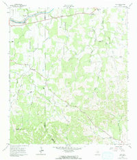
Other maps of this area

1887 · Blanco
USGS Topo · 1:125,000

1894 · Fredericksburg
USGS Topo · 1:125,000

1894 · Blanco
USGS Topo · 1:125,000

1954 · Llano
USGS Topo · 1:250,000

1955 · Llano
USGS Topo · 1:250,000

1956 · Llano
USGS Topo · 1:250,000

1961 · Stonewall
USGS Topo · 1:24,000

1961 · Hye
USGS Topo · 1:24,000

1961 · Cave Creek School
USGS Topo · 1:24,000

1961 · Rocky Creek
USGS Topo · 1:24,000