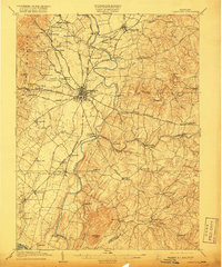
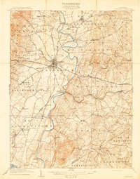
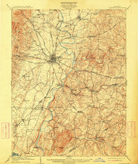
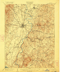
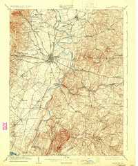
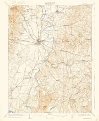
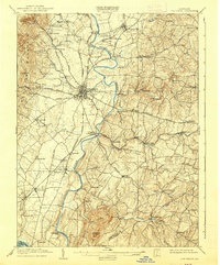
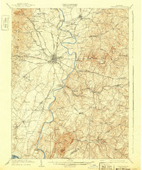
1909 Map of Ijamsville
USGS Topo · Published 1917About this map
The Monocacy River winds through the heart of Frederick County, anchoring a landscape defined by its early 20th-century transportation network. At the center of this 1909 survey, Frederick serves as a critical junction for the Northern Central RR, Frederick RR, and numerous turnpikes like the Emmitsburg Turnpike. The map captures the social and agricultural infrastructure of the era, from the Montevue Almshouse northwest of the city to the mills and small settlements dotting the riverbanks.
Find a feature on this map
87 named features on this map. Tap any name to fly to it.
Don’t see what you’re looking for? This feature index may not catch every label — zoom into the map to look around manually.
Map Details
Editions of this 1909 Ijamsville Map
9 editions found

Other maps of this area

1884 · Harpers Ferry
USGS Topo · 1:125,000

1891 · Harpers Ferry
USGS Topo · 1:125,000

1893 · Frederick
USGS Topo · 1:125,000

1893 · Harpers Ferry
USGS Topo · 1:125,000

1894 · Frederick
USGS Topo · 1:125,000

1908 · Middletown
USGS Topo · 1:48,000

1908 · Rockville
USGS Topo · 1:62,500

1908 · Seneca
USGS Topo · 1:62,500

1908 · Ijamsville
USGS Topo · 1:62,500

1909 · Mount Airy
USGS Topo · 1:62,500