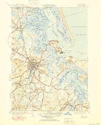
1945 Map of Ipswich
USGS Topo · Published 1951About this map
Ipswich and its intricate coastal landscape are documented here just after the war, showing a region defined by tidal rivers and drumlin hills. The town center is densely clustered along the Ipswich River, with the Boston and Maine Railroad cutting through the western hills near Highland Cem. To the east, the landscape opens into a vast network of salt marshes and winding waterways like the Eagle Hill River and Roger Island River, sheltered by the barrier of Plum Island. Landmark coastal features including Castle Hill and the Ipswich LH stand near Ipswich Bay, while inland, named heights such as Heartbreak Hill and Sagamore Hill punctuate the terrain. This survey captures the transitional period of the early 1950s, where traditional coastal industries and established inland settlements like South Essex and Essex Falls remained central to the local geography.
Find a feature on this map
106 named features on this map. Tap any name to fly to it.
Don’t see what you’re looking for? This feature index may not catch every label — zoom into the map to look around manually.
Map Details
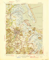
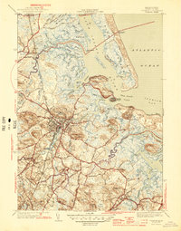
Editions of this 1945 Ipswich Map
3 editions found
Other maps of this area

1886 · Gloucester
USGS Topo · 1:62,500

1888 · Newburyport
USGS Topo · 1:62,500

1888 · Gloucester
USGS Topo · 1:62,500

1888 · Salem
USGS Topo · 1:62,500

1890 · Newburyport
USGS Topo · 1:62,500

1893 · Salem
USGS Topo · 1:62,500

1893 · Gloucester
USGS Topo · 1:62,500

1894 · Newburyport
USGS Topo · 1:62,500

1917 · Salem
USGS Topo · 1:62,500

1918 · Gloucester
USGS Topo · 1:62,500