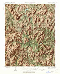
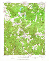
1945 Map of Ironton
USGS Topo · Published 1963About this map
Ironton and Arcadia serve as the central hubs of this mid-century survey, situated in a valley surrounded by some of Missouri's most significant heights. The landscape is dominated by the massive presence of Taum Sauk Mountain 1772 and Shepherd Mountain, highlighting the topographical intensity of the St. Francois Mountains. The industrial heritage of the region is evident at the Ozark Ore Co near Iron Mountain, where mining operations influenced the local rail network of the Missouri Pacific.
Find a feature on this map
96 named features on this map. Tap any name to fly to it.
Don’t see what you’re looking for? This feature index may not catch every label — zoom into the map to look around manually.
Map Details
Editions of this 1945 Ironton Map
6 editions found

Other maps of this area

1904 · Farmington
USGS Topo · 1:62,500

1905 · Bonneterre
USGS Topo · 1:62,500

1906 · Potosi
USGS Topo · 1:62,500

1906 · Farmington
USGS Topo · 1:62,500

1924 · Edgehill
USGS Topo · 1:62,500

1926 · Edgehill
USGS Topo · 1:62,500

1926 · Des Arc
USGS Topo · 1:62,500

1929 · Des Arc
USGS Topo · 1:62,500

1930 · Coldwater
USGS Topo · 1:62,500

1937 · Ironton
USGS Topo · 1:48,000