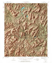
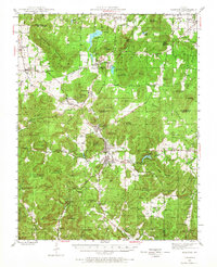
1945 Map of Ironton
USGS Topo · Published 1968About this map
The high peaks of the Arcadia Valley define the landscape of this mid-century survey, centered on the historic settlements of Ironton, Arcadia, and Pilot Knob. This region's industrial legacy is anchored by the Iron Mountain mining area and the Ozark Ore Co Lake, while the Missouri Pacific railroad winds through the valley floor, connecting these towns to the wider state. The map shows a high concentration of community landmarks, including the County Farm, Arcadia Bible Camp, and numerous rural schools like Thorn Grove Sch.
Find a feature on this map
98 named features on this map. Tap any name to fly to it.
Don’t see what you’re looking for? This feature index may not catch every label — zoom into the map to look around manually.
Map Details
Editions of this 1945 Ironton Map
6 editions found

Other maps of this area

1904 · Farmington
USGS Topo · 1:62,500

1905 · Bonneterre
USGS Topo · 1:62,500

1906 · Potosi
USGS Topo · 1:62,500

1906 · Farmington
USGS Topo · 1:62,500

1924 · Edgehill
USGS Topo · 1:62,500

1926 · Edgehill
USGS Topo · 1:62,500

1926 · Des Arc
USGS Topo · 1:62,500

1929 · Des Arc
USGS Topo · 1:62,500

1930 · Coldwater
USGS Topo · 1:62,500

1937 · Ironton
USGS Topo · 1:48,000