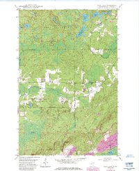
1949 Map of Isaac Lake
USGS Topo · Published 1985About this map
Bear Island State Forest and Superior National Forest define the northern wilderness of St. Louis County, where dense woodlands meet a complex network of glacial water bodies. The Embarrass River meanders through the central landscape, passing the township of Waasa and its local Town Hall. This 1949 survey, updated with 1980s data, illustrates the transition between conservation lands and early 20th-century industry, noted by the presence of several Pits and a large Mine Dump at the southern edge of the quadrangle.
Find a feature on this map
28 named features on this map. Tap any name to fly to it.
Don’t see what you’re looking for? This feature index may not catch every label — zoom into the map to look around manually.
Map Details
Editions of this 1949 Isaac Lake Map
4 editions found
Other maps of this area

1933 · Ely
USGS Topo · 1:62,500

1939 · Ely
USGS Topo · 1:62,500

1949 · Aurora
USGS Topo · 1:24,000

1949 · Isaac Lake
USGS Topo · 1:24,000

1949 · Allen
USGS Topo · 1:24,000

1949 · Embarrass
USGS Topo · 1:24,000

1950 · Isaac Lake
USGS Topo · 1:24,000

1950 · Embarrass
USGS Topo · 1:24,000

1950 · Allen
USGS Topo · 1:24,000

1950 · Aurora
USGS Topo · 1:24,000