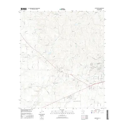
2016 Map of Jasper West
USGS Topo · Published 2016About this map
Jasper serves as the focal point for this Southeast Texas landscape, where the urban grid gives way to the piney drainage basins of Sandy Cr and Indian Cr. The map is particularly notable for its dense distribution of family and community burial grounds, documenting the lineage of rural Jasper County through sites like Hadnot Cem, Trotti Cem, and the uniquely named Little Hope Cem. Settlement patterns follow the winding routes of state and county roads, connecting established neighborhoods like the Minyard Addition and Ryall Acres to outlying locales such as Curtis and Bellows. The southern portion of the quadrangle is dominated by the Jasper County Airport- Bell Field, a modern infrastructure landmark amidst a terrain defined by numerous small creeks and ponds, including Linsey Lake and Pattons Pond.
Find a feature on this map
143 named features on this map. Tap any name to fly to it.
Don’t see what you’re looking for? This feature index may not catch every label — zoom into the map to look around manually.
Map Details
Editions of this 2016 Jasper West Map
This is the sole edition of this map. No revisions or reprints were ever made.
Other maps of this area

1952 · Lake Charles
USGS Topo · 1:250,000

1953 · Alexandria
USGS Topo · 1:250,000

1953 · Palestine
USGS Topo · 1:250,000

1954 · Lake Charles
USGS Topo · 1:250,000

1954 · Beaumont
USGS Topo · 1:250,000

1955 · Alexandria
USGS Topo · 1:250,000

1955 · Roganville
USGS Topo · 1:62,500

1955 · Curtis
USGS Topo · 1:62,500

1957 · Beaumont
USGS Topo · 1:250,000

1957 · Palestine
USGS Topo · 1:250,000