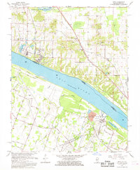
1967 Map of Joppa
USGS Topo · Published 1968About this map
Joppa occupies a strategic bend in the Ohio River during the late 1960s, serving as a hub where industrial activity meets the river landscape. The presence of the massive Shawnee Steam Plant (TVA) and the Paducah Plant (AEC) underscores the region's mid-century role in power generation and national atomic energy infrastructure. These industrial giants stand in contrast to the nearby Mermet Lake State Conservation Area and the West Kentucky State Wildlife Management Area, showcasing the dual nature of land use in this Illinois-Kentucky borderland.
Find a feature on this map
52 named features on this map. Tap any name to fly to it.
Don’t see what you’re looking for? This feature index may not catch every label — zoom into the map to look around manually.
Map Details
Editions of this 1967 Joppa Map
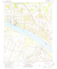
2 editions found
Other maps of this area

1917 · Brownfield
USGS Topo · 1:62,500

1918 · Vienna
USGS Topo · 1:62,500

1919 · Vienna
USGS Topo · 1:62,500

1926 · Paducah
USGS Topo · 1:62,500

1928 · La Center
USGS Topo · 1:62,500

1929 · Paducah
USGS Topo · 1:62,500

1932 · La Center
USGS Topo · 1:62,500

1940 · Paducah
USGS Topo · 1:62,500

1942 · Vienna
USGS Topo · 1:62,500

1949 · Paducah
USGS Topo · 1:250,000