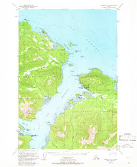
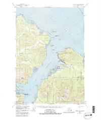
1951 Map of Juneau A-5
USGS Topo · Published 1966About this map
Hoonah serves as the primary settlement on this portion of northern Chichagof Island, situated at the convergence of Hoonah Harbor and Port Frederick. The 1951 field data reveals a maritime economy defined by a Cannery at Inner Point Sophia and a Seaplane Base near the town center, illustrating the vital role of air and sea transport in Southeast Alaska before the expansion of modern road networks.
Find a feature on this map
50 named features on this map. Tap any name to fly to it.
Don’t see what you’re looking for? This feature index may not catch every label — zoom into the map to look around manually.
Map Details
Editions of this 1951 Juneau A-5 Map
6 editions found

Other maps of this area

1948 · Juneau B-4
USGS Topo · 1:63,360

1948 · Juneau B-6
USGS Topo · 1:63,360

1948 · Juneau A-4
USGS Topo · 1:63,360

1948 · Juneau B-5
USGS Topo · 1:63,360

1948 · Sitka D-5
USGS Topo · 1:63,360

1948 · Sitka D-4
USGS Topo · 1:63,360

1948 · Sitka D-6
USGS Topo · 1:63,360

1949 · Juneau B-4
USGS Topo · 1:63,360

1950 · Juneau B-5
USGS Topo · 1:63,360

1951 · Juneau
USGS Topo · 1:250,000
Featured Places
- Hoonah, AK
- Whitestone Logging Camp (Abandoned), AK
- Whitestone Logging Camp, AK
- Game Creek, AK
- Unorganized Borough, AK