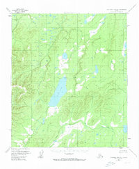
1953 Map of Kantishna River B-3
USGS Topo · Published 1973About this map
Wien Lake dominates the central landscape of this interior Alaska territory, where the surrounding terrain is defined by the complex drainage systems of the Zitziana River and John Hansen Creek. This 1953 survey, based on aerial photography from the previous year, captures a remote wilderness largely untouched by formal development. A single Cabin situated north of the lake provides the only evidence of human habitation on the map, likely serving as a seasonal outpost for trappers or explorers. The intricate contour work illustrates the gradual elevation changes and sprawling wetlands characteristic of the Yukon-Koyukuk region before more modern infrastructure reached this part of the Alaskan wilderness.
Find a feature on this map
5 named features on this map. Tap any name to fly to it.
Don’t see what you’re looking for? This feature index may not catch every label — zoom into the map to look around manually.
Map Details
Editions of this 1953 Kantishna River B-3 Map
3 editions found

Other maps of this area

1948 · Kantishna River
USGS Topo · 1:250,000

1951 · Kantishna River
USGS Topo · 1:250,000

1952 · Kantishna River A-3
USGS Topo · 1:63,360

1952 · Kantishna River
USGS Topo · 1:250,000

1952 · Kantishna River A-2
USGS Topo · 1:63,360

1952 · Kantishna River C-3
USGS Topo · 1:63,360

1952 · Kantishna River C-4
USGS Topo · 1:63,360

1953 · Kantishna River B-2
USGS Topo · 1:63,360

1953 · Kantishna River B-4
USGS Topo · 1:63,360

1953 · Kantishna River A-4
USGS Topo · 1:63,360