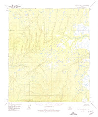
1952 Map of Kantishna River C-6
USGS Topo · Published 1974About this map
Big Mud River snakes through this interior landscape, defining a complex drainage system characterized by numerous small lakes and unnamed ponds. This 1952 topographic study, compiled from aerial photography, captures the wilderness character of the region before significant modern development. The Fairbanks Meridian West Boundary provides a primary surveying benchmark that runs north-to-south through the center-left of the terrain, while the Chitanana River enters the frame in the southeast corner. The absence of roads or trails highlights the reliance on natural waterways for movement through this remote Alaskan interior. The map illustrates the subtle elevation changes of the river basins, where the intricate network of water bodies suggests a seasonally shifting marshland environment.
Find a feature on this map
3 named features on this map. Tap any name to fly to it.
Don’t see what you’re looking for? This feature index may not catch every label — zoom into the map to look around manually.
Map Details
Editions of this 1952 Kantishna River C-6 Map
3 editions found
Other maps of this area

1948 · Kantishna River
USGS Topo · 1:250,000

1951 · Kantishna River
USGS Topo · 1:250,000

1951 · Ruby
USGS Topo · 1:250,000

1952 · Kantishna River C-5
USGS Topo · 1:63,360

1952 · Ruby B-1
USGS Topo · 1:63,360

1952 · Ruby C-1
USGS Topo · 1:63,360

1952 · Kantishna River C-6
USGS Topo · 1:63,360

1952 · Kantishna River D-5
USGS Topo · 1:63,360

1952 · Ruby D-1
USGS Topo · 1:63,360

1952 · Kantishna River
USGS Topo · 1:250,000