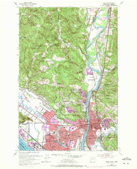
1953 Map of Kelso
USGS Topo · Published 1971About this map
The Cowlitz River serves as the central artery of this region, separating the industrial and residential centers of Kelso and Longview. This survey shows the urban layout during a period of significant mid-century development, including the intricate street grid of West Kelso and the planned residential patterns of Columbia Valley Gardens and Davis Terrace. The landscape is dominated by the confluence where the Cowlitz meets the Columbia River near Slaughters Channel, a vital junction for the regional economy.
Find a feature on this map
45 named features on this map. Tap any name to fly to it.
Don’t see what you’re looking for? This feature index may not catch every label — zoom into the map to look around manually.
Map Details
Editions of this 1953 Kelso Map
3 editions found
Other maps of this area

1919 · Mayger
USGS Topo · 1:62,500

1921 · Kalama
USGS Topo · 1:62,500

1941 · Olequa
USGS Topo · 1:62,500

1941 · Clatskanie
USGS Topo · 1:62,500

1952 · Clatskanie
USGS Topo · 1:62,500

1953 · Hoquiam
USGS Topo · 1:250,000

1953 · Castle Rock
USGS Topo · 1:62,500

1953 · Mt. Brynion
USGS Topo · 1:24,000

1953 · Ryderwood
USGS Topo · 1:62,500

1953 · Rainier
USGS Topo · 1:24,000