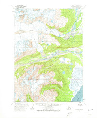
1958 Map of Kenai C-7
USGS Topo · Published 1972About this map
Double Peak and the expansive Double Glacier dominate this wilderness landscape on the western side of the Cook Inlet. The survey reveals a dynamic glacial environment where the Drift River Lobe and Big River Lobe terminate into the drainages that feed the coastal lowlands. The drainage network is complex, characterized by the braiding Drift River and South Fork Big River, which transport glacial silt toward the coast.
Find a feature on this map
15 named features on this map. Tap any name to fly to it.
Don’t see what you’re looking for? This feature index may not catch every label — zoom into the map to look around manually.
Map Details
Editions of this 1958 Kenai C-7 Map
3 editions found
Other maps of this area

1944 · Kenai
USGS Topo · 1:250,000

1950 · Kenai
USGS Topo · 1:250,000

1958 · Kenai B-7
USGS Topo · 1:63,360

1958 · Kenai C-6
USGS Topo · 1:63,360

1958 · Kenai B-8
USGS Topo · 1:63,360

1958 · Kenai D-8
USGS Topo · 1:63,360

1958 · Kenai D-6
USGS Topo · 1:63,360

1958 · Kenai C-8
USGS Topo · 1:63,360

1958 · Kenai D-7
USGS Topo · 1:63,360

1958 · Kenai C-7
USGS Topo · 1:63,360