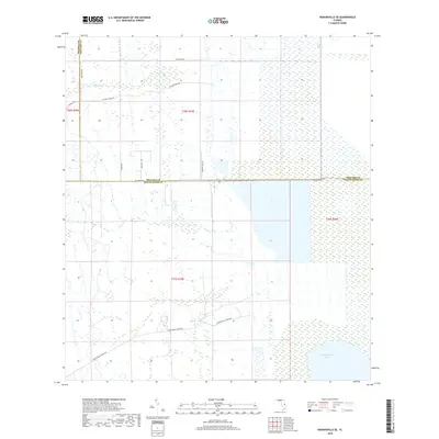
2018 Map of Kenansville SE
USGS Topo · Published 2018About this map
The Saint Johns Marsh dominates this landscape along the borders of Brevard, Osceola, and Indian River counties. This 2018 survey reveals a terrain defined by extensive wetlands and water management, where the northern waters of Blue Cypress Lake meet a network of rural access roads. The transit pattern here is distinctly agricultural and hydrologic, anchored by Blue Cypress Ranch Rd and Rollins Blue Cypres Rd. Local infrastructure is concentrated along the east-west corridor of Fellsmere Rd, which divides the central marshlands. Smaller drainages like Sixmile Cr wind through the north, supported by a grid of named routes including Wye River Rd and Skeeter Lake Rd, illustrating the modern efforts to navigate and maintain the Florida marsh interior.
Find a feature on this map
18 named features on this map. Tap any name to fly to it.
Don’t see what you’re looking for? This feature index may not catch every label — zoom into the map to look around manually.
Map Details
Editions of this 2018 Kenansville SE Map
This is the sole edition of this map. No revisions or reprints were ever made.
Other maps of this area

1953 · Fellsmere SW
USGS Topo · 1:24,000

1953 · Fellsmere NW
USGS Topo · 1:24,000

1953 · Fort Drum NW
USGS Topo · 1:24,000

1953 · Kenansville SW
USGS Topo · 1:24,000

1953 · Kenansville
USGS Topo · 1:24,000

1953 · Fort Drum NE
USGS Topo · 1:24,000

1953 · Kenansville NE
USGS Topo · 1:24,000

1953 · Kenansville SE
USGS Topo · 1:24,000

1953 · Fellsmere 4 NW
USGS Topo · 1:24,000

1956 · Fort Pierce
USGS Topo · 1:250,000