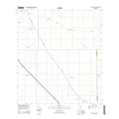
2015 Map of Kenansville SW
USGS Topo · Published 2015About this map
Lokosee serves as a central point of reference in this landscape of the Florida interior, where the modern transit corridor of Florida's Tpke bisects the rural cattle and ranching country of southern Osceola County. The map details a transition between developed infrastructure and the natural drainage systems of the marshy lowlands, specifically where Sixmile Cr and Blue Cypress Cr flow through the eastern reaches. The presence of specialized landing strips such as Flying S Ranch Airport and Escape Ranch Airport underscores the logistical needs of these large, remote agricultural holdings. Secondary routes like S Kenansville Rd and Fellsmere Rd provide the essential local network for the ranching economy, connecting these inland prairies to the broader regional transportation system.
Find a feature on this map
17 named features on this map. Tap any name to fly to it.
Don’t see what you’re looking for? This feature index may not catch every label — zoom into the map to look around manually.
Map Details
Editions of this 2015 Kenansville SW Map
This is the sole edition of this map. No revisions or reprints were ever made.
Other maps of this area

1953 · Fort Kissimmee NE
USGS Topo · 1:24,000

1953 · Lake Marian SE
USGS Topo · 1:24,000

1953 · Fort Drum NW
USGS Topo · 1:24,000

1953 · Kenansville SW
USGS Topo · 1:24,000

1953 · Kenansville
USGS Topo · 1:24,000

1953 · Fort Drum NE
USGS Topo · 1:24,000

1953 · Kenansville NE
USGS Topo · 1:24,000

1953 · Kenansville SE
USGS Topo · 1:24,000

1953 · Lake Marian NE
USGS Topo · 1:24,000

1956 · Fort Pierce
USGS Topo · 1:250,000