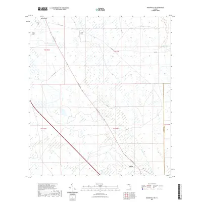
2021 Map of Kenansville SW
USGS Topo · Published 2021About this map
The settlement of Lokosee anchors the southeastern reaches of this Florida interior landscape, where the marshy drainages of Blue Cypress Cr and Sixmile Cr define the hydrological character of the region. The map shows a transition from structured ranching operations to expansive wetland systems, dominated by the diagonal corridor of S Kenansville Rd. This thoroughfare connects the namesake Kenansville in the northwest to the remote outposts further south, reflecting the area's history as a hub for the Florida cattle industry.
Find a feature on this map
20 named features on this map. Tap any name to fly to it.
Don’t see what you’re looking for? This feature index may not catch every label — zoom into the map to look around manually.
Map Details
Editions of this 2021 Kenansville SW Map
This is the sole edition of this map. No revisions or reprints were ever made.
Other maps of this area

1953 · Fort Kissimmee NE
USGS Topo · 1:24,000

1953 · Lake Marian SE
USGS Topo · 1:24,000

1953 · Fort Drum NW
USGS Topo · 1:24,000

1953 · Kenansville SW
USGS Topo · 1:24,000

1953 · Kenansville
USGS Topo · 1:24,000

1953 · Fort Drum NE
USGS Topo · 1:24,000

1953 · Kenansville NE
USGS Topo · 1:24,000

1953 · Kenansville SE
USGS Topo · 1:24,000

1953 · Lake Marian NE
USGS Topo · 1:24,000

1956 · Fort Pierce
USGS Topo · 1:250,000