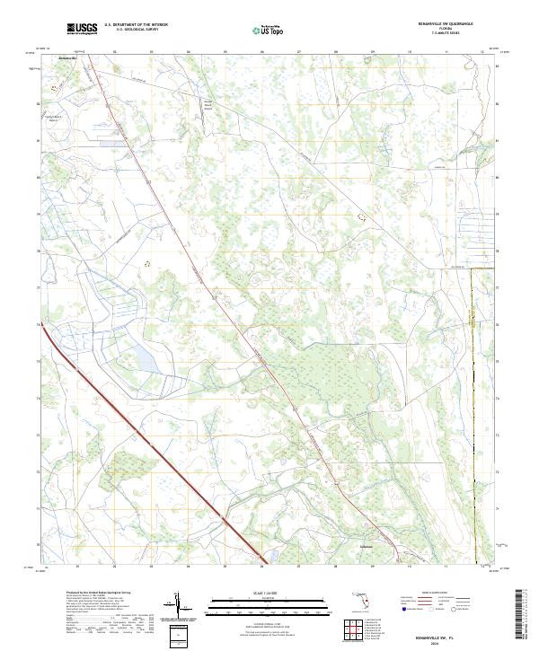
2024 Map of Kenansville SW
USGS Topo · Published 2024About this map
Kenansville anchors the northwest corner of this Osceola County landscape, where the agricultural and aviation traditions of central Florida remain visible. The area is defined by its extensive ranch lands and a network of arterial roads, including the diagonal path of S Kenansville Rd and the straight-line transit of Fellsmere Rd. Small-scale aviation serves these rural tracts at the Flying S Ranch Airport and Escape Ranch Airport, while the southern settlement of Lokosee marks the lower reaches of the quadrangle. Hydrological patterns are shaped by Sixmile Creek in the northeast and Blue Cypress Creek to the southeast, flowing through a terrain patterned with wetlands and ranching operations. The boundary between Osceola Co and Indian River Co runs along the eastern edge, showing the jurisdictional transition within this predominantly open ranching corridor.
Find a feature on this map
21 named features on this map. Tap any name to fly to it.
Don’t see what you’re looking for? This feature index may not catch every label — zoom into the map to look around manually.
Map Details
Editions of this 2024 Kenansville SW Map
This is the sole edition of this map. No revisions or reprints were ever made.
Other maps of this area

1953 · Fort Kissimmee NE
USGS Topo · 1:24,000

1953 · Lake Marian SE
USGS Topo · 1:24,000

1953 · Fort Drum NW
USGS Topo · 1:24,000

1953 · Kenansville SW
USGS Topo · 1:24,000

1953 · Kenansville
USGS Topo · 1:24,000

1953 · Fort Drum NE
USGS Topo · 1:24,000

1953 · Kenansville NE
USGS Topo · 1:24,000

1953 · Kenansville SE
USGS Topo · 1:24,000

1953 · Lake Marian NE
USGS Topo · 1:24,000

1956 · Fort Pierce
USGS Topo · 1:250,000