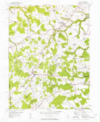
1955 Map of Kenton
USGS Topo · Published 1957About this map
Kenton and the surrounding farmland of Kent County are defined by a network of rural crossroads and drainage ditches in this mid-century survey. The landscape is heavily influenced by the upper reaches of the Leipsic River and its various tributaries, including Jordan Branch and Pinks Branch, which feed into local landmarks like Masseys Millpond. This era of development is captured through the presence of the Pennsylvania Railroad passing through the heart of Hartly and the emergence of early aviation at Lash Airfield.
Find a feature on this map
54 named features on this map. Tap any name to fly to it.
Don’t see what you’re looking for? This feature index may not catch every label — zoom into the map to look around manually.
Map Details
Editions of this 1955 Kenton Map
Other maps of this area

1899 · Dover
USGS Topo · 1:125,000

1900 · Cecilton
USGS Topo · 1:62,500

1905 · Barclay
USGS Topo · 1:62,500

1906 · Dover
USGS Topo · 1:125,000

1920 · Dover
USGS Topo · 1:125,000

1926 · Wyoming
USGS Topo · 1:48,000

1930 · Wyoming
USGS Topo · 1:62,500

1931 · Wyoming
USGS Topo · 1:62,500

1931 · Smyrna
USGS Topo · 1:62,500
1944 · Goldsboro
USGS Topo · 1:31,680