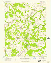
1955 Map of Kenton
USGS Topo · Published 1957About this map
The agricultural landscape of Kent County, Delaware, and eastern Maryland is defined here by a dense network of crossroad settlements and small rural institutions. Centered on Kenton and Hartly, the region is organized into local jurisdictions such as District No 3 and District No 4. The map reveals a high concentration of community centers including Downes Chapel, Forest Grove Ch, and Mt Friendship Sch, many of which served dispersed farming families.
Find a feature on this map
52 named features on this map. Tap any name to fly to it.
Don’t see what you’re looking for? This feature index may not catch every label — zoom into the map to look around manually.
Map Details
Editions of this 1955 Kenton Map
Other maps of this area

1899 · Dover
USGS Topo · 1:125,000

1900 · Cecilton
USGS Topo · 1:62,500

1905 · Barclay
USGS Topo · 1:62,500

1906 · Dover
USGS Topo · 1:125,000

1920 · Dover
USGS Topo · 1:125,000

1926 · Wyoming
USGS Topo · 1:48,000

1930 · Wyoming
USGS Topo · 1:62,500

1931 · Wyoming
USGS Topo · 1:62,500

1931 · Smyrna
USGS Topo · 1:62,500
1944 · Goldsboro
USGS Topo · 1:31,680