
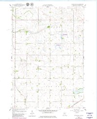
1958 Map of Kerkhoven SE
USGS Topo · Published 1959About this map
The winding course of Hawk Creek defines the lower half of this landscape in Chippewa County, flowing through the townships of Lone Tree and Woods. This 1958 survey captures a classic agrarian grid where rural education and community life were still decentralized across the prairie. The map identifies specific landmarks like School No 301 and School No 317, alongside a local Town Hall. In the southeast corner, the Great Northern railroad cuts a diagonal path toward the horizon, passing near the Sacred Heart Cem. The terrain is dotted with numerous small wetlands and depressions, illustrating the natural glacial prairie pothole topography that predated extensive modern drainage. This document preserves the exact placement of these mid-century rural institutions before many were consolidated or moved.
Find a feature on this map
11 named features on this map. Tap any name to fly to it.
Don’t see what you’re looking for? This feature index may not catch every label — zoom into the map to look around manually.
Map Details
Editions of this 1958 Kerkhoven SE Map
3 editions found
Other maps of this area

1953 · New Ulm
USGS Topo · 1:250,000

1953 · Saint Cloud
USGS Topo · 1:250,000

1957 · Saint Cloud
USGS Topo · 1:250,000

1957 · New Ulm
USGS Topo · 1:250,000

1958 · New Ulm
USGS Topo · 1:250,000

1958 · Saint Cloud
USGS Topo · 1:250,000

1958 · Murdock
USGS Topo · 1:24,000

1958 · Kerkhoven
USGS Topo · 1:24,000

1958 · Kerkhoven SW
USGS Topo · 1:24,000

1958 · Raymond
USGS Topo · 1:24,000