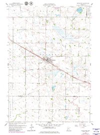
1958 Map of Kerkhoven
USGS Topo · Published 1980About this map
Kerkhoven serves as the primary hub of this west-central Minnesota landscape, situated at the junction of several townships including Hayes, Pillsbury, and Louriston. The town's grid is oriented alongside the diagonal corridor of the Great Northern railroad, a transport artery that fundamentally shaped the development of the region's agricultural economy. This 1958 survey, with revisions from 1977, illustrates the town's expansion toward Hillside Cem and the surrounding rural infrastructure, which includes a network of local roads and an extensive pipeline.
Find a feature on this map
17 named features on this map. Tap any name to fly to it.
Don’t see what you’re looking for? This feature index may not catch every label — zoom into the map to look around manually.
Map Details
Editions of this 1958 Kerkhoven Map
3 editions found
Other maps of this area

1953 · Saint Cloud
USGS Topo · 1:250,000

1957 · Saint Cloud
USGS Topo · 1:250,000

1958 · Saint Cloud
USGS Topo · 1:250,000

1958 · Murdock
USGS Topo · 1:24,000

1958 · Kerkhoven SE
USGS Topo · 1:24,000

1958 · Kerkhoven
USGS Topo · 1:24,000

1958 · Kerkhoven SW
USGS Topo · 1:24,000

1958 · Raymond
USGS Topo · 1:24,000

1958 · Pennock
USGS Topo · 1:24,000

1967 · Sunburg
USGS Topo · 1:24,000