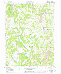
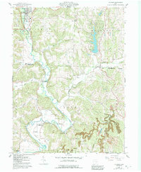
1962 Map of Killbuck
USGS Topo · Published 1978About this map
Killbuck Creek carves a deep path through the landscape of central Ohio, serving as the primary corridor for the Pennsylvania Railroad and defining the settlement patterns of Killbuck, Layland, and Blissfield. This mid-century survey captures a region where agriculture and industry are closely intertwined. Numerous oil wells and extensive mining operations, including the Racetrack Strip Mine and various other Strip Mines, dot the hillsides adjacent to the valley floor. Small community anchors such as Pleasant Grove Ch and the Helmick Sta suggest the social fabric of rural townships like Mechanic and Clark. Genealogists can trace family names through several rural burial grounds, including Elliott Cem, Salem Cem, and Bucklew Cem. The map's detail also highlights the importance of minor waterways like Doughty Creek and Wolf Creek in shaping the local topography at the border of Holmes and Coshocton counties.
Find a feature on this map
33 named features on this map. Tap any name to fly to it.
Don’t see what you’re looking for? This feature index may not catch every label — zoom into the map to look around manually.
Map Details
Editions of this 1962 Killbuck Map
5 editions found
Other maps of this area

1912 · Loudonville
USGS Topo · 1:62,500

1913 · Brinkhaven
USGS Topo · 1:62,500

1913 · Coshocton
USGS Topo · 1:62,500

1914 · Loudonville
USGS Topo · 1:62,500

1915 · Brinkhaven
USGS Topo · 1:62,500

1915 · Millersburg
USGS Topo · 1:62,500

1915 · Coshocton
USGS Topo · 1:62,500

1943 · Millersburg
USGS Topo · 1:62,500

1943 · Coshocton
USGS Topo · 1:62,500

1943 · Loudonville
USGS Topo · 1:62,500