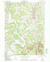
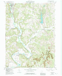
1962 Map of Killbuck
USGS Topo · Published 1985About this map
The valley of Killbuck Creek dominates this Holmes County landscape, serving as a primary corridor for both the Conrail line and rural settlement. In the early 1960s, the village of Killbuck functioned as a local hub, supported by nearby resources like a Quarry and various oil and gas wells. To the south and east, the map reveals a deeply etched topography of ridges and hollows, where small hamlets like Layland, Clark, and Helmick are tucked along watercourses such as Doughty Creek and Wolf Creek.
Find a feature on this map
41 named features on this map. Tap any name to fly to it.
Don’t see what you’re looking for? This feature index may not catch every label — zoom into the map to look around manually.
Map Details
Editions of this 1962 Killbuck Map
5 editions found
Other maps of this area

1912 · Loudonville
USGS Topo · 1:62,500

1913 · Brinkhaven
USGS Topo · 1:62,500

1913 · Coshocton
USGS Topo · 1:62,500

1914 · Loudonville
USGS Topo · 1:62,500

1915 · Brinkhaven
USGS Topo · 1:62,500

1915 · Millersburg
USGS Topo · 1:62,500

1915 · Coshocton
USGS Topo · 1:62,500

1943 · Millersburg
USGS Topo · 1:62,500

1943 · Coshocton
USGS Topo · 1:62,500

1943 · Loudonville
USGS Topo · 1:62,500