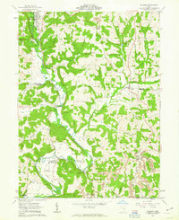
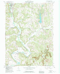
1962 Map of Killbuck
USGS Topo · Published 1963About this map
The Pennsylvania railroad corridor defines the narrow valley of Killbuck Creek during the early 1960s, threading through the rural landscape of Holmes and Coshocton Counties. This survey captures the region's extraction and transit economy, evidenced by a Strip Mine and a Quarry situated near the small settlements of Helmick and Blissfield. A Gaging Station and a Covered Bridge appear as significant local landmarks along the creek's winding path.
Find a feature on this map
34 named features on this map. Tap any name to fly to it.
Don’t see what you’re looking for? This feature index may not catch every label — zoom into the map to look around manually.
Map Details
Editions of this 1962 Killbuck Map
5 editions found
Other maps of this area

1912 · Loudonville
USGS Topo · 1:62,500

1913 · Brinkhaven
USGS Topo · 1:62,500

1913 · Coshocton
USGS Topo · 1:62,500

1914 · Loudonville
USGS Topo · 1:62,500

1915 · Brinkhaven
USGS Topo · 1:62,500

1915 · Millersburg
USGS Topo · 1:62,500

1915 · Coshocton
USGS Topo · 1:62,500

1943 · Millersburg
USGS Topo · 1:62,500

1943 · Coshocton
USGS Topo · 1:62,500

1943 · Loudonville
USGS Topo · 1:62,500