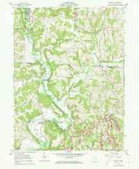
1962 Map of Killbuck
USGS Topo · Published 1973About this map
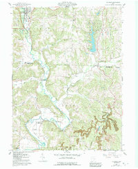
Killbuck serves as the primary hub in this early 1960s landscape, situated where Wolf Creek joins the larger Killbuck Creek valley. The map reveals a rural economy transitioning between traditional agriculture and resource extraction, evidenced by scattered Oil Wells, a Strip Mine, and several local quarries. Small clusters of settlement like Layland, Blissfield, and Helmick dot the corridor of the Pennsylvania rail line, which follows the winding creek bed through the hills. Genealogists will find a high density of family and community burial grounds, including Salem Cem, Clark Cem, and the remote Elliott Cem on the eastern ridges. A notable architectural detail is the Covered Bridge crossing Doughty Creek south of Clark, a remnant of earlier transportation engineering preserved in this mid-century survey. The terrain is defined by deep-cut runs like Hoagland Run and Big Run, which carve the landscape into a series of narrow ridges and hollows.
Find a feature on this map
40 named features on this map. Tap any name to fly to it.
Don’t see what you’re looking for? This feature index may not catch every label — zoom into the map to look around manually.
Map Details
Editions of this 1962 Killbuck Map
5 editions found
Other maps of this area

1912 · Loudonville
USGS Topo · 1:62,500

1913 · Brinkhaven
USGS Topo · 1:62,500

1913 · Coshocton
USGS Topo · 1:62,500

1914 · Loudonville
USGS Topo · 1:62,500

1915 · Brinkhaven
USGS Topo · 1:62,500

1915 · Millersburg
USGS Topo · 1:62,500

1915 · Coshocton
USGS Topo · 1:62,500

1943 · Millersburg
USGS Topo · 1:62,500

1943 · Coshocton
USGS Topo · 1:62,500

1943 · Loudonville
USGS Topo · 1:62,500