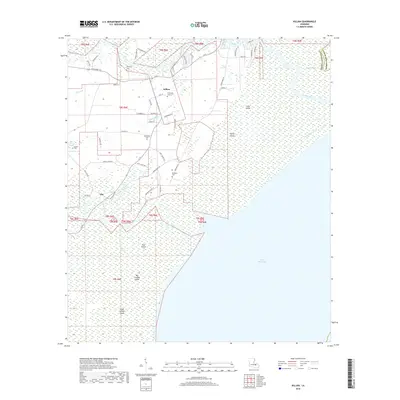
2018 Map of Killian
USGS Topo · Published 2018About this map
The Amite River and Tickfaw River converge toward the cypress-lined shores of Lake Maurepas in this detailed 2018 survey of Livingston Parish. The village of Killian serves as a central hub, with its grid of local streets like Wild St and Mitchell St reaching toward the winding Killian Bayou. The landscape is dominated by expansive wetlands and low-lying island formations, including Big Liveoak Island, Little Liveoak Island, and Pine Island, which define the deltaic character of the region.
Find a feature on this map
61 named features on this map. Tap any name to fly to it.
Don’t see what you’re looking for? This feature index may not catch every label — zoom into the map to look around manually.
Map Details
Editions of this 2018 Killian Map
This is the sole edition of this map. No revisions or reprints were ever made.
Other maps of this area

1892 · Mount Airy
USGS Topo · 1:62,500

1892 · Bonnet Carre
USGS Topo · 1:62,500

1934 · Springfield
USGS Topo · 1:62,500

1935 · Ponchatoula
USGS Topo · 1:62,500

1936 · Ruddock
USGS Topo · 1:31,680

1936 · Bonnet Carre
USGS Topo · 1:62,500

1939 · Ponchatoula
USGS Topo · 1:62,500

1939 · Springfield
USGS Topo · 1:62,500

1946 · North of Garyville
USGS Topo · 1:31,680

1946 · Petite Amite River
USGS Topo · 1:31,680