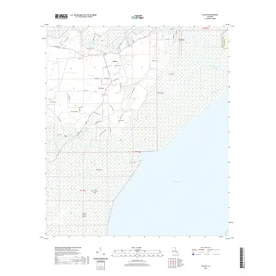
2020 Map of Killian
USGS Topo · Published 2020About this map
Killian and Clio serve as the primary residential hubs in this wetland-rich region of Livingston Parish, where the local economy and geography are defined by the convergence of major waterways. The Tickfaw River and Amite River wind through the landscape toward the expanse of Lake Maurepas, creating a network of bayous and low-lying landforms like Big Liveoak Island and Pine Island. This 2020 survey details a transition from the structured residential blocks of Killian to the more isolated settlements along the river bends. Genealogists will find several family-named burial sites documented across the quadrangle, including McKinney Cem, Schroeder Cem, and Davidson Cem. The presence of the Lake Shore Canal and Cutoff Canal illustrates the ongoing management of this hydraulic landscape, where roads like La 22 and LA Highway 444 provide the essential terrestrial links between these waterfront communities.
Find a feature on this map
59 named features on this map. Tap any name to fly to it.
Don’t see what you’re looking for? This feature index may not catch every label — zoom into the map to look around manually.
Map Details
Editions of this 2020 Killian Map
This is the sole edition of this map. No revisions or reprints were ever made.
Other maps of this area

1892 · Mount Airy
USGS Topo · 1:62,500

1892 · Bonnet Carre
USGS Topo · 1:62,500

1934 · Springfield
USGS Topo · 1:62,500

1935 · Ponchatoula
USGS Topo · 1:62,500

1936 · Ruddock
USGS Topo · 1:31,680

1936 · Bonnet Carre
USGS Topo · 1:62,500

1939 · Ponchatoula
USGS Topo · 1:62,500

1939 · Springfield
USGS Topo · 1:62,500

1946 · North of Garyville
USGS Topo · 1:31,680

1946 · Petite Amite River
USGS Topo · 1:31,680