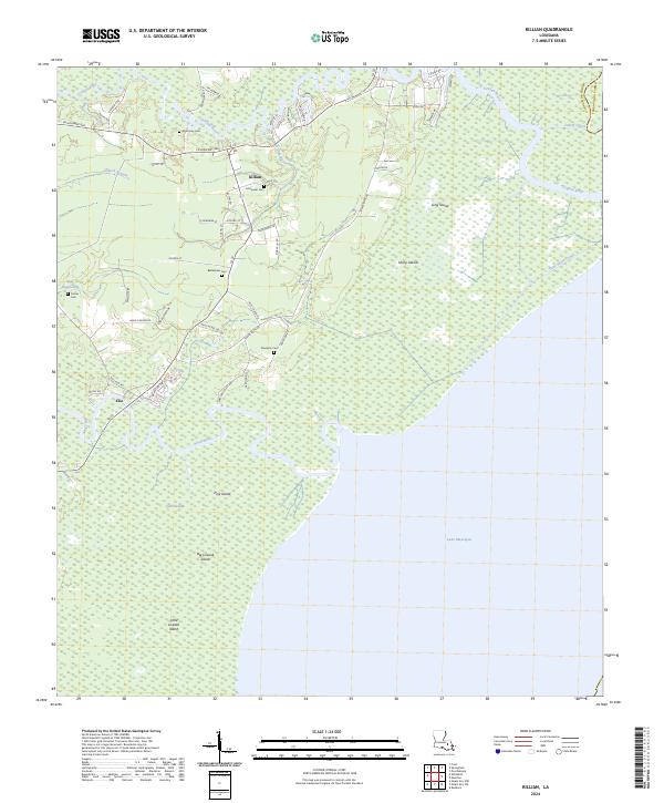
2024 Map of Killian
USGS Topo · Published 2024About this map
The Tickfaw River and Amite River converge toward the northern reaches of Lake Maurepas, defining a landscape where land and water are inextricably linked. This modern survey shows the settlements of Killian and Clio situated among an intricate network of waterways and low-lying landforms like Long Island and Big Liveoak Island. Local history and genealogy are well-represented by several family and community burial sites, including McKinney Cem, Schroeder Cem, and Bethlehem Cem, which are scattered throughout the wooded terrain.
Find a feature on this map
63 named features on this map. Tap any name to fly to it.
Don’t see what you’re looking for? This feature index may not catch every label — zoom into the map to look around manually.
Map Details
Editions of this 2024 Killian Map
This is the sole edition of this map. No revisions or reprints were ever made.
Other maps of this area

1892 · Mount Airy
USGS Topo · 1:62,500

1892 · Bonnet Carre
USGS Topo · 1:62,500

1934 · Springfield
USGS Topo · 1:62,500

1935 · Ponchatoula
USGS Topo · 1:62,500

1936 · Ruddock
USGS Topo · 1:31,680

1936 · Bonnet Carre
USGS Topo · 1:62,500

1939 · Ponchatoula
USGS Topo · 1:62,500

1939 · Springfield
USGS Topo · 1:62,500

1946 · North of Garyville
USGS Topo · 1:31,680

1946 · Petite Amite River
USGS Topo · 1:31,680