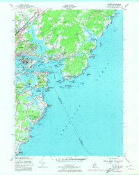
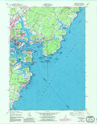
1956 Map of Kittery
USGS Topo · Published 1974About this map
The Piscataqua River separates the maritime communities of Kittery, Maine, and Portsmouth, New Hampshire, in this coastal survey. The landscape is defined by its deep military and naval history, anchoring the mouth of the harbor with a dense network of defensive installations. The Portsmouth Naval Shipyard dominates Seavey Island, while historical fortifications like Fort Constitution and Ft Mcclary State Park stand watch over the channel.
Find a feature on this map
142 named features on this map. Tap any name to fly to it.
Don’t see what you’re looking for? This feature index may not catch every label — zoom into the map to look around manually.
Map Details
Editions of this 1956 Kittery Map
5 editions found
Other maps of this area

1888 · Newburyport
USGS Topo · 1:62,500

1890 · Newburyport
USGS Topo · 1:62,500

1893 · Dover
USGS Topo · 1:62,500

1893 · York
USGS Topo · 1:62,500

1894 · Newburyport
USGS Topo · 1:62,500

1916 · Dover
USGS Topo · 1:62,500

1918 · Dover
USGS Topo · 1:62,500

1920 · York
USGS Topo · 1:62,500

1932 · Newburyport
USGS Topo · 1:48,000

1934 · Exeter
USGS Topo · 1:62,500