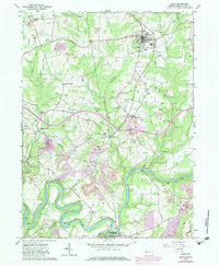
1963 Map of Knox
USGS Topo · Published 1980About this map
The Oil Field and numerous gas wells define this portion of Clarion County in the early 1960s, showing a landscape shaped by persistent resource extraction. The Baltimore and Ohio railroad corridor links the borough of Knox with surrounding rural crossroads like Wentlings Corners and Blairs Corners. To the south, the Clarion River snakes through the terrain in dramatic meanders, notably at Turnip Hole, where it forms the boundary between Licking and Perry townships.
Find a feature on this map
51 named features on this map. Tap any name to fly to it.
Don’t see what you’re looking for? This feature index may not catch every label — zoom into the map to look around manually.
Map Details
Editions of this 1963 Knox Map
4 editions found
Other maps of this area

1906 · Clarion
USGS Topo · 1:62,500

1907 · Clarion
USGS Topo · 1:62,500

1907 · Foxburg
USGS Topo · 1:62,500

1908 · Foxburg
USGS Topo · 1:62,500

1922 · Oil City
USGS Topo · 1:48,000

1922 · Tionesta
USGS Topo · 1:62,500

1924 · Oil City
USGS Topo · 1:62,500

1924 · Tionesta
USGS Topo · 1:62,500

1943 · Oil City
USGS Topo · 1:62,500

1946 · Tionesta
USGS Topo · 1:62,500