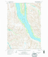
1952 Map of Kodiak B-6
USGS Topo · Published 1972About this map
Amook Island sits at the heart of this mid-century maritime survey, sheltered within the deep waters of Uyak Bay. The map documents a landscape where life was tied almost exclusively to the coast, indicated by the presence of a Seaplane Base and a Camp along Amook Bay. Traces of earlier industry and settlement are visible through the notation of Ruins and a Mine (Aband) on the island, while a Cem suggests a more permanent community once resided here.
Find a feature on this map
34 named features on this map. Tap any name to fly to it.
Don’t see what you’re looking for? This feature index may not catch every label — zoom into the map to look around manually.
Map Details
Editions of this 1952 Kodiak B-6 Map
3 editions found
Other maps of this area

1951 · Karluk
USGS Topo · 1:250,000

1952 · Kodiak
USGS Topo · 1:250,000

1952 · Karluk
USGS Topo · 1:250,000

1952 · Kodiak B-6
USGS Topo · 1:63,360

1952 · Karluk B-1
USGS Topo · 1:63,360

1952 · Kodiak C-5
USGS Topo · 1:63,360

1952 · Kodiak B-5
USGS Topo · 1:63,360

1952 · Karluk C-1
USGS Topo · 1:63,360

1952 · Kodiak C-6
USGS Topo · 1:63,360

1952 · Karluk A-1
USGS Topo · 1:63,360