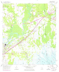
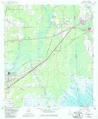
1958 Map of Kreole
USGS Topo · Published 1978About this map
The Es Catawpa River winds through a landscape of wetlands and developing infrastructure along the Mississippi-Alabama border. Settlement clusters around the Louisville and Nashville railroad corridor, which serves as a primary axis for the communities of Orange Grove, Pecan, and the industrial hubs of Moss Point and Kreole. The map documents a period of significant change, with a large highway interchange marked as under construction northeast of the Kivisto Cem. Local life is anchored by landmarks such as the Orange Lake Sch, Franklin Creek Ch, and the Fundarosa Airport. To the southeast, the terrain transitions into the expanse of the Grand Bay Swamp and a network of tidal waters including Bayou Heron and Mattie Clark Bayou, illustrating the area's coastal character before late-20th-century development further altered the wetlands.
Find a feature on this map
42 named features on this map. Tap any name to fly to it.
Don’t see what you’re looking for? This feature index may not catch every label — zoom into the map to look around manually.
Map Details
Editions of this 1958 Kreole Map
5 editions found
Other maps of this area

1921 · Grand Bay
USGS Topo · 1:62,500

1941 · Hurley
USGS Topo · 1:62,500

1941 · Vancleave
USGS Topo · 1:62,500

1943 · Pascagoula
USGS Topo · 1:62,500

1943 · Grand Bay
USGS Topo · 1:62,500

1943 · Hurley
USGS Topo · 1:62,500

1943 · Vancleave
USGS Topo · 1:62,500

1944 · Vancleave
USGS Topo · 1:62,500

1953 · Mobile
USGS Topo · 1:250,000

1955 · Pascagoula
USGS Topo · 1:62,500