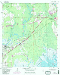
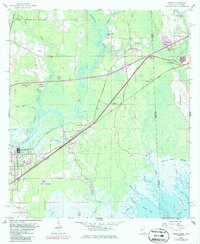
1958 Map of Kreole
USGS Topo · Published 1986About this map
The Es Catawpa River carves a winding path through this coastal boundary region, defining the landscape where Jackson County meets the Alabama state line. By the mid-20th century, the area saw significant development between the established industrial center at Moss Point and the newer residential pockets of Orange Grove. The Seaboard railroad cuts a diagonal line across the terrain, serving the community of Kreole and passing near the Orange Lake Sch. Further north, smaller settlements like Helena and Franklin sit among a network of tributaries including Black Creek and Jackson Creek.
Find a feature on this map
42 named features on this map. Tap any name to fly to it.
Don’t see what you’re looking for? This feature index may not catch every label — zoom into the map to look around manually.
Map Details
Editions of this 1958 Kreole Map
5 editions found
Other maps of this area

1921 · Grand Bay
USGS Topo · 1:62,500

1941 · Hurley
USGS Topo · 1:62,500

1941 · Vancleave
USGS Topo · 1:62,500

1943 · Pascagoula
USGS Topo · 1:62,500

1943 · Grand Bay
USGS Topo · 1:62,500

1943 · Hurley
USGS Topo · 1:62,500

1943 · Vancleave
USGS Topo · 1:62,500

1944 · Vancleave
USGS Topo · 1:62,500

1953 · Mobile
USGS Topo · 1:250,000

1955 · Pascagoula
USGS Topo · 1:62,500