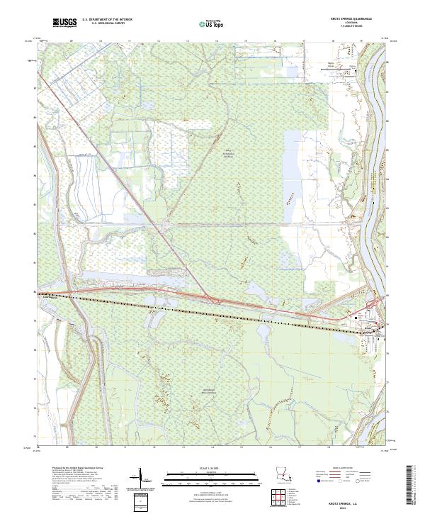
2024 Map of Krotz Springs
USGS Topo · Published 2024About this map
The Atchafalaya River creates a natural divide along the eastern edge of this landscape, separating St. Landry from Pointe Coupee Parish. At the center of this riverine environment lies the town of Krotz Springs, a settlement defined by its proximity to the water and its role within the West Atchafalaya Floodway. The map captures a complex network of waterways, including Bayou Courtableau, Two O'clock Bayou, and the Bayou Courtableau Outlet Channel, illustrating the sophisticated water management systems required in the Atchafalaya Basin Floodway.
Find a feature on this map
70 named features on this map. Tap any name to fly to it.
Don’t see what you’re looking for? This feature index may not catch every label — zoom into the map to look around manually.
Map Details
Editions of this 2024 Krotz Springs Map
This is the sole edition of this map. No revisions or reprints were ever made.
Other maps of this area

1935 · Osca Bayou
USGS Topo · 1:62,500

1939 · Fordoche
USGS Topo · 1:62,500

1940 · Arnaudville
USGS Topo · 1:62,500

1954 · Baton Rouge
USGS Topo · 1:250,000

1955 · Osca Bayou
USGS Topo · 1:62,500

1955 · Fordoche
USGS Topo · 1:62,500

1956 · Baton Rouge
USGS Topo · 1:250,000
1959 · Osca Bayou
USGS Topo · 1:62,500

1959 · Fordoche
USGS Topo · 1:62,500

1959 · Palmetto
USGS Topo · 1:62,500