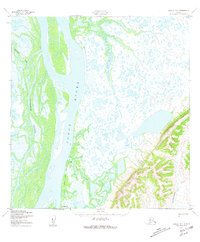
1952 Map of Kwiguk B-4
USGS Topo · Published 1959About this map
The Yukon River dominates this landscape in the Kusilvak region of Alaska, branching into a complex network of waterways that include the Pektotolik Slough and Tunurokpak Channel. In the early 1950s, this area was characterized by seasonal movement and remote outposts, evidenced by the presence of Patsys Cabin and other unnamed Cabins located near the riverbank. This survey provides a look at the seasonal infrastructure of the region, noting a Winter Trail that cuts across the marshy lowlands, likely used when the terrain was frozen and passable. To the southeast, the terrain rises into higher elevations where the Anuk River and Archuelinguk River navigate through more structured valleys, contrasting with the delta-like complexity of the western portion of the map.
Find a feature on this map
8 named features on this map. Tap any name to fly to it.
Don’t see what you’re looking for? This feature index may not catch every label — zoom into the map to look around manually.
Map Details
Editions of this 1952 Kwiguk B-4 Map
3 editions found
Other maps of this area

1952 · Kwiguk
USGS Topo · 1:250,000

1952 · Kwiguk B-3
USGS Topo · 1:63,360

1952 · Kwiguk C-3
USGS Topo · 1:63,360

1952 · Kwiguk A-5
USGS Topo · 1:63,360

1952 · Kwiguk B-5
USGS Topo · 1:63,360

1952 · Kwiguk C-4
USGS Topo · 1:63,360

1952 · Kwiguk A-4
USGS Topo · 1:63,360

1952 · Kwiguk C-5
USGS Topo · 1:63,360

1952 · Kwiguk A-3
USGS Topo · 1:63,360

1952 · Kwiguk B-4
USGS Topo · 1:63,360