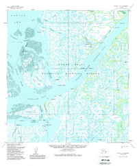
1952 Map of Kwiguk C-6
USGS Topo · Published 1988About this map
The Yukon River branches into a complex maze of waterways across this delta landscape, defining a remote region where water and land are nearly inseparable. Near the river's path, settlements like Alakanuk and Sheldon Point serve as vital hubs for movement along the Kwikluak Pass. These small outposts, featuring a Landing Strip and proximity to the Bering Sea, highlight the logistical importance of aviation and river transit in the early 1950s.
Find a feature on this map
51 named features on this map. Tap any name to fly to it.
Don’t see what you’re looking for? This feature index may not catch every label — zoom into the map to look around manually.
Map Details
Editions of this 1952 Kwiguk C-6 Map
3 editions found
Other maps of this area

1951 · Black
USGS Topo · 1:250,000

1952 · Kwiguk
USGS Topo · 1:250,000
1952 · Black C-1
USGS Topo · 1:63,360

1952 · Black B-1
USGS Topo · 1:63,360

1952 · Kwiguk C-6
USGS Topo · 1:63,360

1952 · Kwiguk B-6
USGS Topo · 1:63,360

1952 · Kwiguk B-5
USGS Topo · 1:63,360

1952 · Kwiguk D-6
USGS Topo · 1:63,360

1952 · Kwiguk C-5
USGS Topo · 1:63,360

1952 · Kwiguk D-5
USGS Topo · 1:63,360