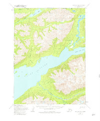
1954 Map of Lake Clark B-3
USGS Topo · Published 1980About this map
Lake Clark dominates this mid-century topographic study, where the waters of Little Lake Clark meet the broader lake at a narrow pinch point. The map illustrates a landscape shaped by significant glacial and river systems, including the Kijik River and the braided channels of the Tlikakila River. High alpine terrain is anchored by the presence of Copper Mountain to the south, while numerous smaller bodies of water like Lachbuna Lake, Otter Lake, and Portage Lake are scattered across the northern reaches.
Find a feature on this map
16 named features on this map. Tap any name to fly to it.
Don’t see what you’re looking for? This feature index may not catch every label — zoom into the map to look around manually.
Map Details
Editions of this 1954 Lake Clark B-3 Map
3 editions found
Other maps of this area

1946 · Lake Clark
USGS Topo · 1:250,000

1951 · Lake Clark
USGS Topo · 1:250,000

1954 · Lake Clark C-3
USGS Topo · 1:63,360

1954 · Lake Clark C-4
USGS Topo · 1:63,360

1954 · Lake Clark A-3
USGS Topo · 1:63,360

1954 · Lake Clark B-3
USGS Topo · 1:63,360

1954 · Lake Clark A-4
USGS Topo · 1:63,360

1954 · Lake Clark B-4
USGS Topo · 1:63,360

1958 · Lake Clark C-2
USGS Topo · 1:63,360
1958 · Lake Clark A-2
USGS Topo · 1:63,360