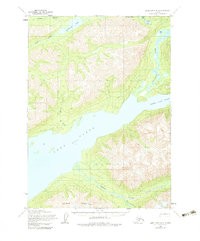
1954 Map of Lake Clark B-3
USGS Topo · Published 1983About this map
Lake Clark dominates this interior Alaskan landscape, where the glacially carved waters meet the towering elevations of Copper Mountain. Based on surveys conducted in the early 1950s, the map reveals a wilderness primarily accessed by water and traditional overland routes, including a significant Native Trail traversing the shoreline near Portage Creek. The convergence of the Kijik River and the braided channels of the Tlikakila River into the head of the lake illustrates the complex hydrologic network of the region. Isolated Cabins stand as the only noted human structures, emphasizing the seasonal and subsistence patterns of the area before major modern developments. To the north, Lachbuna Lake and College Creek feed into the broader valley, while smaller alpine bodies like Saddle Lake and Otter Lake occupy the higher ridges.
Find a feature on this map
15 named features on this map. Tap any name to fly to it.
Don’t see what you’re looking for? This feature index may not catch every label — zoom into the map to look around manually.
Map Details
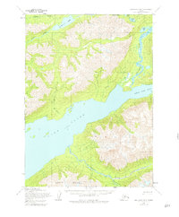
Editions of this 1954 Lake Clark B-3 Map
3 editions found
Other maps of this area

1946 · Lake Clark
USGS Topo · 1:250,000

1951 · Lake Clark
USGS Topo · 1:250,000

1954 · Lake Clark C-3
USGS Topo · 1:63,360

1954 · Lake Clark C-4
USGS Topo · 1:63,360

1954 · Lake Clark A-3
USGS Topo · 1:63,360

1954 · Lake Clark B-3
USGS Topo · 1:63,360

1954 · Lake Clark A-4
USGS Topo · 1:63,360

1954 · Lake Clark B-4
USGS Topo · 1:63,360

1958 · Lake Clark C-2
USGS Topo · 1:63,360
1958 · Lake Clark A-2
USGS Topo · 1:63,360