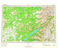
1958 Map of Lake Clark
USGS Topo · Published 1967This historical map portrays the area of Lake Clark in 1958, primarily covering Lake and Peninsula Borough as well as portions of Bethel Borough and Kenai Peninsula. Featuring a scale of 1:250000, this map provides a highly detailed snapshot of the terrain, roads, buildings, counties, and historical landmarks in the Lake Clark region at the time. Published in 1967, it is one of 4 known editions of this map due to revisions or reprints.
Find a feature on this map
67 named features on this map. Tap any name to fly to it.
Don’t see what you’re looking for? This feature index may not catch every label — zoom into the map to look around manually.
Map Details
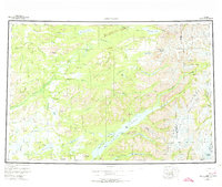
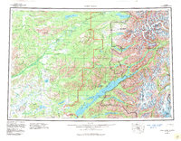
Editions of this 1958 Lake Clark Map
4 editions found
Historical Maps of Port Alsworth Through Time
156 maps found

1946 Lake Clark
Lake and Peninsula Borough, AK

1948 Mt Katmai
Lake and Peninsula Borough, AK

1951 Bristol Bay
Lake and Peninsula Borough, AK

1951 Dillingham A-1
Lake and Peninsula Borough, AK

1951 Iliamna A-6
Lake and Peninsula Borough, AK

1951 Iliamna A-7
Lake and Peninsula Borough, AK

1951 Iliamna A-8
Lake and Peninsula Borough, AK

1951 Iliamna B-5
Lake and Peninsula Borough, AK

1951 Iliamna B-6
Lake and Peninsula Borough, AK

1951 Iliamna B-7
Lake and Peninsula Borough, AK

1951 Karluk D-5
Lake and Peninsula Borough, AK

1951 Karluk D-6
Lake and Peninsula Borough, AK

1951 Lake Clark
Lake and Peninsula Borough, AK

1951 Mount Katmai A-6
Lake and Peninsula Borough, AK

1951 Mount Katmai B-3
Lake and Peninsula Borough, AK

1951 Mount Katmai B-5
Lake and Peninsula Borough, AK

1951 Mount Katmai B-6
Lake and Peninsula Borough, AK

1951 Mount Katmai C-2
Lake and Peninsula Borough, AK

1951 Mount Katmai C-3
Lake and Peninsula Borough, AK

1951 Mount Katmai C-4
Lake and Peninsula Borough, AK

1951 Mount Katmai C-5
Lake and Peninsula Borough, AK

1951 Mount Katmai C-6
Lake and Peninsula Borough, AK

1951 Mount Katmai D-3
Lake and Peninsula Borough, AK

1951 Mount Katmai D-4
Lake and Peninsula Borough, AK

1951 Mount Katmai D-6
Lake and Peninsula Borough, AK

1951 Mt. Katmai A-5
Lake and Peninsula Borough, AK

1951 Mt. Katmai B-4
Lake and Peninsula Borough, AK

1951 Mt. Katmai B-5
Lake and Peninsula Borough, AK

1951 Mt Katmai
Lake and Peninsula Borough, AK

1951 Naknek A-1
Lake and Peninsula Borough, AK

1951 Naknek A-2
Lake and Peninsula Borough, AK

1951 Naknek A-3
Lake and Peninsula Borough, AK

1951 Naknek A-4
Lake and Peninsula Borough, AK

1951 Naknek A-5
Lake and Peninsula Borough, AK

1951 Naknek B-1
Lake and Peninsula Borough, AK

1951 Naknek C-1
Lake and Peninsula Borough, AK

1951 Naknek D-1
Lake and Peninsula Borough, AK

1951 Stepovak Bay
Lake and Peninsula Borough, AK

1951 Sutwik Island
Lake and Peninsula Borough, AK

1951 Ugashik A-2
Lake and Peninsula Borough, AK

1951 Ugashik B-3
Lake and Peninsula Borough, AK

1951 Ugashik C-1
Lake and Peninsula Borough, AK

1951 Ugashik C-2
Lake and Peninsula Borough, AK

1951 Ugashik C-3
Lake and Peninsula Borough, AK

1951 Ugashik C-4
Lake and Peninsula Borough, AK

1951 Ugashik C-5
Lake and Peninsula Borough, AK

1951 Ugashik C-6
Lake and Peninsula Borough, AK

1951 Ugashik D-1
Lake and Peninsula Borough, AK

1951 Ugashik D-2
Lake and Peninsula Borough, AK

1951 Ugashik D-3
Lake and Peninsula Borough, AK

1951 Ugashik D-4
Lake and Peninsula Borough, AK

1951 Ugashik D-5 and D-6
Lake and Peninsula Borough, AK

1952 Dillingham A-2
Lake and Peninsula Borough, AK

1952 Dillingham A-3
Lake and Peninsula Borough, AK

1952 Iliamna A-8
Lake and Peninsula Borough, AK

1952 Naknek B-2
Lake and Peninsula Borough, AK

1952 Naknek B-3
Lake and Peninsula Borough, AK

1952 Naknek B-4
Lake and Peninsula Borough, AK

1952 Naknek B-5
Lake and Peninsula Borough, AK

1952 Naknek C-6
Lake and Peninsula Borough, AK

1953 Mount Katmai B-5
Lake and Peninsula Borough, AK

1953 Mount Katmai C-2
Lake and Peninsula Borough, AK

1953 Mount Katmai C-5
Lake and Peninsula Borough, AK

1953 Mt. Katmai B-6
Lake and Peninsula Borough, AK

1954 Dillingham B-1
Lake and Peninsula Borough, AK

1954 Dillingham B-2
Lake and Peninsula Borough, AK

1954 Iliamna B-5
Lake and Peninsula Borough, AK

1954 Iliamna B-6
Lake and Peninsula Borough, AK

1954 Iliamna B-8
Lake and Peninsula Borough, AK

1954 Iliamna C-3
Lake and Peninsula Borough, AK

1954 Iliamna C-4
Lake and Peninsula Borough, AK

1954 Iliamna C-5
Lake and Peninsula Borough, AK

1954 Iliamna C-6
Lake and Peninsula Borough, AK

1954 Iliamna C-7
Lake and Peninsula Borough, AK

1954 Iliamna C-8
Lake and Peninsula Borough, AK

1954 Iliamna D-3
Lake and Peninsula Borough, AK

1954 Iliamna D-4
Lake and Peninsula Borough, AK

1954 Iliamna D-5
Lake and Peninsula Borough, AK

1954 Iliamna D-6
Lake and Peninsula Borough, AK

1954 Iliamna D-7
Lake and Peninsula Borough, AK

1954 Iliamna D-8
Lake and Peninsula Borough, AK

1954 Lake Clark A-3
Lake and Peninsula Borough, AK

1954 Lake Clark A-4
Lake and Peninsula Borough, AK

1954 Lake Clark A-5
Lake and Peninsula Borough, AK

1954 Lake Clark A-6
Lake and Peninsula Borough, AK

1954 Lake Clark A-7
Lake and Peninsula Borough, AK

1954 Lake Clark A-8
Lake and Peninsula Borough, AK

1954 Lake Clark B-3
Lake and Peninsula Borough, AK

1954 Lake Clark B-4
Lake and Peninsula Borough, AK

1954 Lake Clark B-5
Lake and Peninsula Borough, AK

1954 Lake Clark B-6
Lake and Peninsula Borough, AK

1954 Lake Clark B-7
Lake and Peninsula Borough, AK

1954 Lake Clark B-8
Lake and Peninsula Borough, AK

1954 Lake Clark C-3
Lake and Peninsula Borough, AK

1954 Lake Clark C-4
Lake and Peninsula Borough, AK

1954 Lake Clark C-5
Lake and Peninsula Borough, AK

1954 Lake Clark C-6
Lake and Peninsula Borough, AK

1954 Lake Clark C-7
Lake and Peninsula Borough, AK

1954 Lake Clark C-8
Lake and Peninsula Borough, AK

1954 Lake Clark D-3
Lake and Peninsula Borough, AK

1954 Lake Clark D-4
Lake and Peninsula Borough, AK

1954 Lake Clark D-5
Lake and Peninsula Borough, AK

1954 Lake Clark D-6
Lake and Peninsula Borough, AK

1954 Lake Clark D-7
Lake and Peninsula Borough, AK

1954 Lake Clark D-8
Lake and Peninsula Borough, AK

1954 Sutwik Island D-3
Lake and Peninsula Borough, AK

1954 Ugashik A-3
Lake and Peninsula Borough, AK

1954 Ugashik B-4
Lake and Peninsula Borough, AK

1954 Ugashik B-5
Lake and Peninsula Borough, AK

1958 Lake Clark B-2
Lake and Peninsula Borough, AK

1958 Lake Clark C-2
Lake and Peninsula Borough, AK

1958 Lake Clark D-2
Lake and Peninsula Borough, AK

1958 Lake Clark
Lake and Peninsula Borough, AK

1963 Bristol Bay A-1
Lake and Peninsula Borough, AK

1963 Bristol Bay A-2
Lake and Peninsula Borough, AK

1963 Bristol Bay B-1
Lake and Peninsula Borough, AK

1963 Bristol Bay
Lake and Peninsula Borough, AK

1963 Chignik A-1
Lake and Peninsula Borough, AK

1963 Chignik A-2
Lake and Peninsula Borough, AK

1963 Chignik A-3
Lake and Peninsula Borough, AK

1963 Chignik A-4
Lake and Peninsula Borough, AK

1963 Chignik A-5
Lake and Peninsula Borough, AK

1963 Chignik B-1
Lake and Peninsula Borough, AK

1963 Chignik B-2
Lake and Peninsula Borough, AK

1963 Chignik B-3
Lake and Peninsula Borough, AK

1963 Chignik B-4
Lake and Peninsula Borough, AK

1963 Chignik B-5
Lake and Peninsula Borough, AK

1963 Chignik B-6
Lake and Peninsula Borough, AK

1963 Chignik C-1
Lake and Peninsula Borough, AK

1963 Chignik C-2
Lake and Peninsula Borough, AK

1963 Chignik C-3
Lake and Peninsula Borough, AK

1963 Chignik C-4
Lake and Peninsula Borough, AK

1963 Chignik D-1
Lake and Peninsula Borough, AK

1963 Chignik D-2
Lake and Peninsula Borough, AK

1963 Chignik D-3
Lake and Peninsula Borough, AK

1963 Stepovak Bay D-2
Lake and Peninsula Borough, AK

1963 Stepovak Bay D-3
Lake and Peninsula Borough, AK

1963 Stepovak Bay D-4
Lake and Peninsula Borough, AK

1963 Stepovak Bay D-5
Lake and Peninsula Borough, AK

1963 Stepovak Bay
Lake and Peninsula Borough, AK

1963 Sutwik Island B-6
Lake and Peninsula Borough, AK

1963 Sutwik Island C-4
Lake and Peninsula Borough, AK

1963 Sutwik Island C-5
Lake and Peninsula Borough, AK

1963 Sutwik Island C-6
Lake and Peninsula Borough, AK

1963 Sutwik Island D-4
Lake and Peninsula Borough, AK

1963 Sutwik Island D-5
Lake and Peninsula Borough, AK

1963 Sutwik Island D-6
Lake and Peninsula Borough, AK

1963 Sutwik Island
Lake and Peninsula Borough, AK

1963 Ugashik A-4
Lake and Peninsula Borough, AK

1963 Ugashik A-5
Lake and Peninsula Borough, AK

1963 Ugashik A-6
Lake and Peninsula Borough, AK

1963 Ugashik B-6
Lake and Peninsula Borough, AK

1964 Mt. Katmai
Lake and Peninsula Borough, AK

1967 Bristol Bay
Lake and Peninsula Borough, AK

1969 Stepovak Bay
Lake and Peninsula Borough, AK

1989 Sutwik Island D-2
Lake and Peninsula Borough, AK