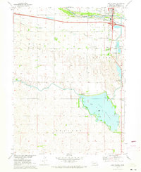
1970 Map of Lake Maloney
USGS Topo · Published 1973About this map
The South Platte River corridor south of North Platte serves as the focal point of this 1970s study, where the landscape transitions from river bottomlands to the engineered water systems of the Missouri River Basin project. The Outlet Canal feeds into the expansive Lake Maloney, a central feature defined by Scout Island and Goose Island. This area reflects a mid-century infrastructure landscape, featuring a Powerhouse, Substation, and the North Platte Fish Hatchery alongside established rural institutions.
Find a feature on this map
35 named features on this map. Tap any name to fly to it.
Don’t see what you’re looking for? This feature index may not catch every label — zoom into the map to look around manually.
Map Details
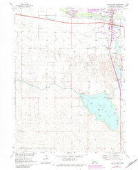
Editions of this 1970 Lake Maloney Map
2 editions found
Other maps of this area

1899 · North Platte
USGS Topo · 1:125,000

1902 · North Platte
USGS Topo · 1:125,000

1954 · McCook
USGS Topo · 1:250,000

1954 · North Platte
USGS Topo · 1:250,000

1956 · North Platte
USGS Topo · 1:250,000

1956 · Wellfleet NW
USGS Topo · 1:24,000

1957 · North Platte
USGS Topo · 1:250,000

1957 · McCook
USGS Topo · 1:250,000

1958 · McCook
USGS Topo · 1:250,000

1967 · North Platte
USGS Topo · 1:250,000