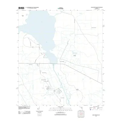
2012 Map of Lake Marian SW
USGS Topo · Published 2012About this map
Lake Kissimmee and the winding Kissimmee River dominate this Central Florida landscape, defined by a complex network of wetland features and named hammocks. This modern era survey illustrates the developed recreation and travel corridors near the water, anchored by the River Ranch Resort Airport and residential streets like Canterbury Dr and Riviera Dr. The topography is characterized by slightly elevated rises or "hammocks" that provide dry ground amidst the surrounding sloughs and canals, including Godwin Hammock, Buzzard Hammock, and the expansive Turkey Hammock.
Find a feature on this map
28 named features on this map. Tap any name to fly to it.
Don’t see what you’re looking for? This feature index may not catch every label — zoom into the map to look around manually.
Map Details
Editions of this 2012 Lake Marian SW Map
This is the sole edition of this map. No revisions or reprints were ever made.
Other maps of this area

1952 · Lake Weohyakapka SE
USGS Topo · 1:24,000

1952 · Lake Weohyakapka NE
USGS Topo · 1:24,000

1952 · Fort Kissimmee NW
USGS Topo · 1:24,000

1952 · Lake Arbuckle NE
USGS Topo · 1:24,000

1953 · Lake Marian NW
USGS Topo · 1:24,000

1953 · Fort Kissimmee NE
USGS Topo · 1:24,000

1953 · Lake Marian SE
USGS Topo · 1:24,000

1953 · Lake Marian SW
USGS Topo · 1:24,000

1953 · Lake Marian NE
USGS Topo · 1:24,000

1956 · Fort Pierce
USGS Topo · 1:250,000