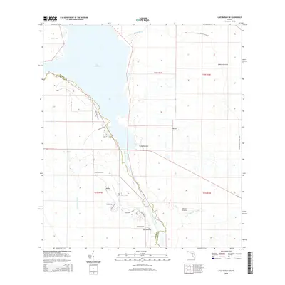
2015 Map of Lake Marian SW
USGS Topo · Published 2015About this map
Lake Kissimmee and the Kissimmee River dominate this Central Florida landscape along the border of Polk and Osceola counties. The terrain is defined by numerous hammocks—elevated stands of hardwood trees amidst the wetlands—including Ute Hammock, Sheep Hammock, and Wildcat Hammock. These features provide a clear picture of the region's traditional cattle ranching and recreational geography before further development.
Find a feature on this map
33 named features on this map. Tap any name to fly to it.
Don’t see what you’re looking for? This feature index may not catch every label — zoom into the map to look around manually.
Map Details
Editions of this 2015 Lake Marian SW Map
This is the sole edition of this map. No revisions or reprints were ever made.
Other maps of this area

1952 · Lake Weohyakapka SE
USGS Topo · 1:24,000

1952 · Lake Weohyakapka NE
USGS Topo · 1:24,000

1952 · Fort Kissimmee NW
USGS Topo · 1:24,000

1952 · Lake Arbuckle NE
USGS Topo · 1:24,000

1953 · Lake Marian NW
USGS Topo · 1:24,000

1953 · Fort Kissimmee NE
USGS Topo · 1:24,000

1953 · Lake Marian SE
USGS Topo · 1:24,000

1953 · Lake Marian SW
USGS Topo · 1:24,000

1953 · Lake Marian NE
USGS Topo · 1:24,000

1956 · Fort Pierce
USGS Topo · 1:250,000