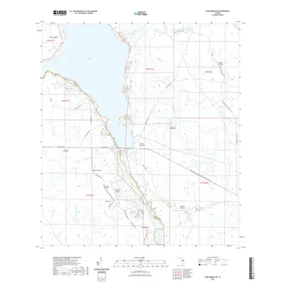
2021 Map of Lake Marian SW
USGS Topo · Published 2021About this map
Lake Kissimmee dominates the northern landscape, where the waters of the Kissimmee River system define the border between Osceola and Polk counties. This central Florida interior region is characterized by a network of drainage channels and wetlands, including the Jackson Canal and several sloughs like Packingham Slough and Blanket Bay Slough. The terrain is punctuated by numerous hammocks—distinctive stands of hardwood trees—such as Turkey Hammock, Godwin Hammock, and Wildcat Hammock, which provide higher ground amidst the surrounding marshes.
Find a feature on this map
40 named features on this map. Tap any name to fly to it.
Don’t see what you’re looking for? This feature index may not catch every label — zoom into the map to look around manually.
Map Details
Editions of this 2021 Lake Marian SW Map
This is the sole edition of this map. No revisions or reprints were ever made.
Other maps of this area

1952 · Lake Weohyakapka SE
USGS Topo · 1:24,000

1952 · Lake Weohyakapka NE
USGS Topo · 1:24,000

1952 · Fort Kissimmee NW
USGS Topo · 1:24,000

1952 · Lake Arbuckle NE
USGS Topo · 1:24,000

1953 · Lake Marian NW
USGS Topo · 1:24,000

1953 · Fort Kissimmee NE
USGS Topo · 1:24,000

1953 · Lake Marian SE
USGS Topo · 1:24,000

1953 · Lake Marian SW
USGS Topo · 1:24,000

1953 · Lake Marian NE
USGS Topo · 1:24,000

1956 · Fort Pierce
USGS Topo · 1:250,000